



If you stepped out in Kolkata this morning and found the sky the colour of wet slate, you were not imagining things. The India Meteorological Department’s Regional Meteorological Centre at Alipore has flagged another spell of thundery weather across Bengal, and the pattern driving it is not going anywhere for the next few days.
The good news, if you want to call it that, is that Kolkata itself is not under a heavy rain warning right now. The less good news is that the city sits squarely inside the zone where thunderstorms, lightning and sudden gusty winds are considered very likely, which in practice is what causes most of the disruption on a working weekday.
What the IMD bulletin actually says
The Regional Meteorological Centre, Kolkata issued Special Bulletin No. 3 on 8 September 2026 at 12:30 pm IST, covering thunderstorm, lightning and intense rainfall activity over parts of West Bengal.
For the 24 hours running from the morning of 9 September to the morning of 10 September, the bulletin forecasts light to moderate rain or thundershowers at many places across every district of South Bengal. Heavy rain, which the IMD defines as 64.5 mm to 115.5 mm in a day (roughly 7 cm to 11 cm), is very likely at one or two places over East Midnapore, West Midnapore and South 24 Parganas.
Alongside that, thunderstorms with lightning and gusty winds reaching 30 to 40 kmph are very likely at one or two places over all districts of South Bengal. That phrase, all districts, is the part Kolkata residents should note, because it takes in the city and its immediate neighbours.
What has already fallen
In the 24 hours ending at 8:30 am on 8 September, Alipore in Kolkata logged 2 cm of rain. Elsewhere in South Bengal the totals were heavier:
- Durgachack, East Midnapore: 9 cm
- Canning, South 24 Parganas: 4 cm
- Midnapore, West Midnapore: 4 cm
- Mohanpur, West Midnapore: 3 cm
- Krishnanagar, Nadia: 3 cm
Why the rain is not letting up
Two systems are stacked on top of each other. The monsoon trough at mean sea level currently runs through Firozpur, Muzaffarnagar, Basti and Dehri, then out to Digha on the Bengal coast and south-eastwards into the northeast Bay of Bengal. When the trough parks its eastern end on our doorstep like this, moist air keeps feeding inland and the afternoons turn unstable.
On top of that, the IMD expects a fresh low pressure area to form over the west-central and northwest Bay of Bengal, near the north Andhra Pradesh and south Odisha coasts, around 11 September. Systems that form in that corner of the Bay have a long history of dragging rain bands across Bengal as they move inland, so the wet stretch is likely to extend past the middle of the month rather than clear off neatly.
The bulletin’s own outlook for 11 to 15 September is light to moderate rain at a few places across South Bengal. Not a washout, but not a dry week either.
What this means on the ground in Kolkata
Anyone who has lived through a Kolkata monsoon knows the pattern. It is rarely the total rainfall that breaks the day, it is where the water sits and how quickly the drains clear it.
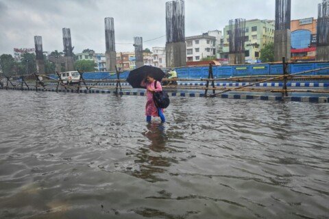
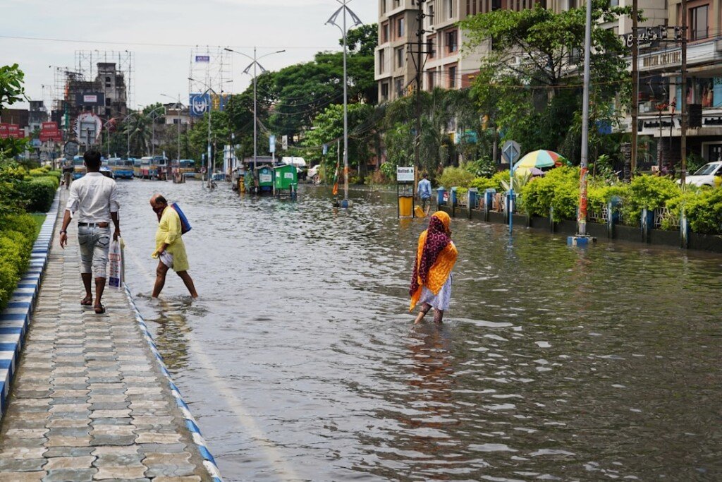
The IMD’s own impact list for South Bengal names three things: lightning strikes, particularly in open ground, waterlogging in low lying areas, and damage to standing crops and horticulture. In city terms, the second one translates into the usual pressure points. In past monsoons the same pockets have tended to hold water longest after a sharp burst, including stretches around Thanthania and Muktaram Babu Street in the north, the Camac Street and Theatre Road belt in the centre, and parts of Behala, Thakurpukur and the Kidderpore approach in the south and southwest.
The gusty wind warning matters too. Winds of 30 to 40 kmph do not sound dramatic on paper, but in a city carrying as much old signage, bamboo scaffolding and roadside tree cover as Kolkata, that is enough to bring down branches and hoardings during a squall. With pandal frames going up across the city ahead of the festival season, loose bamboo and stored cloth are worth securing before the next burst.
Practical tips for the next few days
- Build a buffer into your commute. Late afternoon and evening are the likeliest window for squalls, which overlaps with the office return rush.
- If a thunderstorm starts while you are outdoors, get inside a building or a vehicle. Do not shelter under a tree, beside an electric pole or against a metal hoarding.
- Stay off open ground, rooftops and the edges of waterbodies during lightning. The IMD flags open fields as the highest risk setting.
- Avoid walking through standing water where you cannot see the road surface. Open manholes and live cables are the real hazard, not the water itself.
- Keep your phone charged and a small torch handy. Squall lines often take local power out for short spells.
- If you ride a two wheeler, expect poor visibility and slick tram tracks. The stretches with exposed tracks turn treacherous within minutes of a shower.
- Check the RMC Kolkata bulletin rather than a generic weather app before committing to a long trip. The regional centre updates its warning every day.
Frequently asked questions
Is there a red alert for Kolkata right now?
No. The latest bulletin does not place Kolkata under a heavy rain warning. The city falls under the forecast for light to moderate rain with thunderstorms, lightning and gusty winds of 30 to 40 kmph, which is a lower level of concern than the heavy rain flagged for East Midnapore, West Midnapore and South 24 Parganas.
How much rain counts as heavy in an IMD bulletin?
The IMD classifies 64.5 mm to 115.5 mm in 24 hours as heavy rain, 115.6 mm to 204.4 mm as very heavy rain, and anything above 204.5 mm as extremely heavy rain. Bengal bulletins usually express these in centimetres, so heavy rain appears as 07 to 11 cm.
What does one or two places mean in the forecast?
It is the IMD’s wording for isolated coverage, meaning the event is expected over 25 per cent or less of the area in question. A few places means 26 to 50 per cent, many places means 51 to 75 per cent, and most places means 76 to 100 per cent. So an isolated heavy rain warning does not mean an entire district will get 9 cm of rain.
Will this affect Durga Puja preparations?
Pandal construction is already under way across the city, and a wet stretch in early September is a familiar problem for organisers working with bamboo and cloth. Durga Puja falls in the second half of October this year, so the festival days themselves are well outside the range of this bulletin. The immediate concern is protecting half built structures and stored materials from wind and water.
Is North Bengal worse off?
In places, yes. Jalpaiguri and Alipurduar recorded the highest rainfall in the state in the last reporting period, with 7 cm at Kurti Tea Estate and 6 cm at Majherdabri Tea Garden. The bulletin keeps heavy rain in the picture for Jalpaiguri, Alipurduar, Cooch Behar, Darjeeling and Kalimpong later in the week, which is worth knowing if you have travel planned to the hills or the Dooars.
The Bottom Line
This is not a cyclone week and it is not a repeat of a cloudburst. It is a stubborn monsoon pattern with a fresh Bay system queued up behind it, which means scattered thundery spells rather than one big event. For Kolkata that adds up to a manageable but irritating few days: sudden downpours, brief waterlogging in the usual pockets, and enough lightning risk that being caught in the open is genuinely worth avoiding. Plan for delays, keep an umbrella in the bag, and read the day’s bulletin before you commit to a long trip.
Sources: India Meteorological Department, Regional Meteorological Centre Kolkata, Special Bulletin No. 3 (Ref. No. RMCKOL-13020/4/2025-RWFC-KOL), issued 8 September 2026 at 12:30 pm IST and published at mausam.imd.gov.in/kolkata. All rainfall figures, warning categories, spatial distribution definitions and impact advisories in this report are as stated in that bulletin. Cross-checked against IMD regional forecast summaries carried in the national press on 7 and 8 September 2026. The IMD reissues this warning daily, so check the regional centre for the current position before travelling.
Featured image: people walking through a flooded city street during monsoon rain, photo by Dibakar Roy on Unsplash.