



A fresh low-pressure area has parked itself over Gangetic West Bengal and the adjoining stretches of Jharkhand and north Odisha, and it is keeping Kolkata’s monsoon very much alive. The India Meteorological Department’s Regional Meteorological Centre in Kolkata says South Bengal, this city included, should expect another round of thundershowers, lightning and gusty winds today, with the system expected to track north-westwards into Jharkhand and Odisha over the next day. It is a different system from the one that soaked the city in the third week of August, but the practical advice for anyone stepping out today is much the same: keep an umbrella handy and budget extra time for the commute.
What IMD’s Latest Bulletin Says
In its press release issued on 24 August at 1 pm IST, RMC Kolkata placed the low-pressure area over Gangetic West Bengal and adjoining areas of Jharkhand and north Odisha as of 8:30 am that morning. The associated cyclonic circulation extends up to 7.6 km above mean sea level and tilts south-westwards with height, a sign the system still has some vertical strength even as it weakens. IMD expects it to move nearly north-westwards across Jharkhand and north Odisha over the following 24 hours, carrying the heaviest weather away from Bengal even as the wider monsoon trough, which runs from Amritsar through Varanasi to the low itself and on to the north Bay of Bengal, keeps the region unsettled.
How Much Rain Has Already Fallen
The 24 hours before the bulletin were already wet across the state. In South Bengal, Burnpur in Paschim Bardhaman, Kharagpur and Midnapore in West Midnapore, Kalaikunda and Tusuma in Purulia, and Asansol all logged around 3 cm of rain. North Bengal saw more: Jiti Tea Estate and Alipurduar town each recorded 6 cm, as did Chalouni Tea Estate in Jalpaiguri, while Falakata logged 5 cm and Jhallong, Toorsa Tea Garden and Dharala Valley Tea Estate each saw around 3 cm.
Forecast for Kolkata Today, August 25
For Kolkata and the rest of South Bengal, IMD’s forecast for today calls for light to moderate rain or thundershowers at many places across all districts. On top of that base forecast, the bulletin specifically flags thunderstorms, lightning and gusty winds of 30 to 40 kmph at one or two places over North and South 24 Parganas, East and West Midnapore, Jhargram, Purulia, Bankura, and, notably, Kolkata and Howrah districts themselves. A second source, Asianet Newsable, corroborates this pattern, reporting scattered thundershowers likely across South 24 Parganas, Howrah, Hooghly, East and West Medinipur, Jhargram, Nadia and Murshidabad, with humidity sitting between 84 and 95 percent, the kind of muggy, charged air that typically precedes an evening thunderstorm in the city.
The pattern is expected to hold through 26 and 27 August, with light to moderate rain likely at many places across South Bengal on both days. IMD has also flagged a possible spike around 30 August, when heavy rain of 7 to 11 cm is likely at one or two places in South 24 Parganas and East Midnapore.
North Bengal Faces the Heavier Rain
The sharper warning today is for the hills and the Dooars. IMD has forecast heavy rain of 7 to 11 cm at one or two places in Jalpaiguri and Alipurduar districts, alongside thunderstorms, lightning and gusty winds across all North Bengal districts. That heavy-rain risk for Jalpaiguri and Alipurduar is expected to continue in some form through most of the coming week, with Darjeeling and Kalimpong joining the list again around 29 August.
Fishermen and Coastal Advisory
Away from the city, IMD’s bulletin warned of squally winds of 40 to 50 kmph, gusting to 60 kmph, over the north Bay of Bengal and along the West Bengal and Odisha coasts, and advised fishermen not to venture out on the day the bulletin was issued. Conditions at sea in a spell like this can stay rough for longer than the land forecast suggests, so anyone with a fishing or boating trip planned along the Bengal or Odisha coast this week should check for an updated advisory before heading out rather than relying on this alone.
Waterlogging: Areas Kolkata Commuters Should Watch
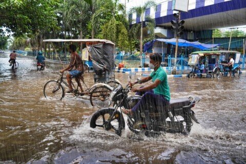
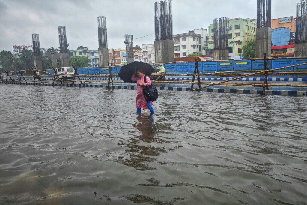
Today’s forecast is for thunderstorms at isolated spots rather than the sustained heavy rain that caused serious flooding earlier this monsoon, but Kolkata’s drainage struggles don’t need much to show up. The city’s usual trouble spots, the Patipukur underpass, and low-lying stretches around Maniktala, Shyambazar, Girish Park, Ultadanga, Tala, Belgachia, Salt Lake and Chinar Park, are worth avoiding or budgeting extra time around if a thunderstorm cell parks itself over the city this evening. For a fuller area-by-area breakdown and which modes of transport tend to hold up best in the rain, our Kolkata monsoon commute survival guide is worth a look before you head out.
How This Compares to Earlier This Month
This is a separate weather system from the depression that brought thundershowers and a waterlogging warning to the city in mid-August. That system had already tracked into Jharkhand and Bihar and was weakening. This one formed fresh over the Bay of Bengal and has now settled over Gangetic Bengal itself before IMD expects it to move on towards Jharkhand and Odisha. In practical terms, that means today’s risk for Kolkata is more about scattered thunderstorm cells and lightning than city-wide sustained downpour, though the situation can change quickly once a system sits this close.
Staying Safe Today
- Carry rain gear and build extra time into your commute, especially through low-lying stretches and underpasses.
- During a thunderstorm, take shelter in a solid building. Avoid standing under trees or near electric poles, and keep away from open water bodies.
- Watch for traffic regulation or diversions if rain intensifies in the evening, particularly around the usual flooding hotspots.
- If you’re crossing the Hooghly by ferry, confirm the service is running before you leave; rough water can lead to short suspensions during spells like this. Our ferry routes and timings guide covers the alternatives.
- Keep half an eye on IMD Kolkata’s updates through the day; today’s bulletin will be revised tomorrow with fresh figures.
Frequently Asked Questions
Will it rain in Kolkata today, August 25?
Yes. IMD’s Kolkata bulletin, issued 24 August, forecasts light to moderate rain or thundershowers across South Bengal today, with a specific thunderstorm, lightning and gusty-wind warning for Kolkata and Howrah districts among others.
Is this the same weather system that flooded parts of Kolkata earlier this month?
No. This is a fresh low-pressure area that formed over the Bay of Bengal and has now settled over Gangetic West Bengal, distinct from the depression covered in our earlier report that had already weakened over Jharkhand and Bihar.
Which parts of Kolkata are most likely to see waterlogging?
Chronic hotspots this monsoon have included the Patipukur underpass and low-lying pockets around Maniktala, Shyambazar, Girish Park, Ultadanga, Tala, Belgachia, Salt Lake and Chinar Park. None are guaranteed to flood today, but they’re worth avoiding if rain intensifies.
Is a red alert in force for Kolkata?
No. Today’s IMD bulletin forecasts thunderstorms and gusty winds at isolated spots over Kolkata and Howrah, not the sustained heavy rainfall that would trigger a red alert for the city. North Bengal districts such as Jalpaiguri and Alipurduar face the sharper heavy-rain warning today.
Should fishermen go out to sea today?
IMD has warned of squally winds gusting to 60 kmph over the north Bay of Bengal and along the West Bengal and Odisha coasts. Anyone with a trip planned should check for the latest coastal advisory before heading out.
The Bottom Line
Kolkata’s monsoon isn’t done yet. Today’s low-pressure system is expected to move away from Bengal and into Jharkhand and Odisha within a day, so this doesn’t look like a repeat of the city’s worst flooding this season, but the thunderstorm and gusty-wind warning for Kolkata and Howrah is real enough to plan around, especially during the evening commute. Keep rain gear within reach and check back with Kolkata Dekho as IMD updates the picture tomorrow.
Featured image: Kolkata street flooded during monsoon rain, photo by Dibakar Roy on Unsplash.