



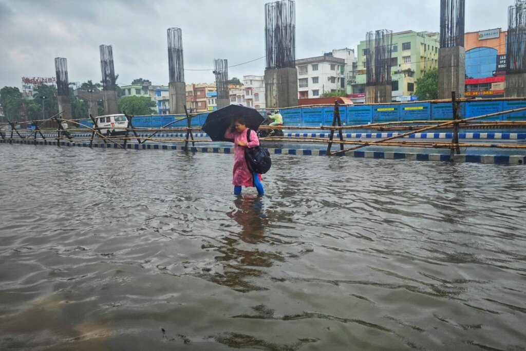

The quiet Karam Puja holiday that IMD had pencilled in for Kolkata is about to give way to the wettest stretch of the month. The Regional Meteorological Centre at Alipore issued a special bulletin at 1 pm on Monday, September 21, confirming that the low pressure which formed over the Andaman Sea at the weekend has already strengthened into a well-marked low over the west-central and adjoining east-central Bay of Bengal. It is expected to become a depression within 24 hours and a deep depression within 48, before crossing near the north Andhra Pradesh and south Odisha coasts around Wednesday morning. Kolkata is not in the direct path, but the city sits squarely on the wet northern flank, and the Alipore office now has rain at many to most places across every South Bengal district from Tuesday, September 22, through Saturday, September 26, with a fishing ban on the Bengal coast and squally winds off Digha and the Sundarbans.
What the System Is Doing Right Now
According to the IMD bulletin, the low pressure area that formed over the east-central Bay and the north Andaman Sea on Saturday evening moved west-northwestwards and became a well-marked low at 5:30 am on Monday. By 8:30 am it lay over the west-central and adjoining east-central Bay of Bengal, with the associated cyclonic circulation reaching 7.6 km above sea level, which is the mark of a system with real depth. IMD expects it to keep moving west-northwestwards, intensify into a depression over the west-central Bay during the next 24 hours, and into a deep depression over the west-central and adjoining north-west Bay in the 24 hours after that. Its landfall zone remains the north Andhra Pradesh and south Odisha coast, around the morning of Wednesday, September 23.
There is a second feature that matters for Kolkata. A north-south trough now runs from the north Bay of Bengal down to the centre of the system, extending 3.1 km up. That trough is the conveyor belt that will pull moisture straight into Gangetic West Bengal even as the core of the system tracks south of us. It is the reason the rain forecast for Bengal has been upgraded despite the landfall being two states away. We covered the origins of this system in our weekend weather report, when it was still a circulation over Thailand.
Day-by-Day Forecast for Kolkata and South Bengal
The Alipore office’s warning chart for South Bengal, which covers Kolkata alongside Howrah, Hooghly and the two 24 Parganas, runs like this:
- Tuesday, September 22 (till 8:30 am Wednesday): light to moderate rain or thundershowers very likely at many places over all South Bengal districts. Heavy rain of 7 to 11 cm at one or two places over South 24 Parganas, East Midnapore and West Midnapore. Thunderstorm, lightning and gusty winds of 40 to 50 kmph over South 24 Parganas and East Midnapore, and 30 to 40 kmph elsewhere, including Kolkata.
- Wednesday, September 23: rain at most places across South Bengal. Heavy rain at one or two places over South 24 Parganas, East and West Midnapore and Jhargram. Same thunderstorm and wind warnings as Tuesday.
- Thursday, September 24: the peak day. Rain at most places. Heavy to very heavy rain of 7 to 20 cm at one or two places over East and West Midnapore and Jhargram, and heavy rain over South 24 Parganas, Bankura, Purulia, West Burdwan, Birbhum and Howrah. Kolkata itself carries the thunderstorm and 30 to 40 kmph gust warning but no heavy rain flag as of Monday.
- Friday, September 25: rain at most places. Heavy rain at one or two places over West Midnapore, Jhargram, Bankura, West Burdwan and Purulia as the system moves inland to the west.
- Saturday, September 26 to Monday, September 28: rain or thundershowers at many places across South Bengal, easing gradually.
The important distinction for city readers is that Kolkata’s own district forecast is for light to moderate rain at many places on Tuesday and most places from Wednesday, with thunderstorm and gusty wind warnings, but the 7 to 11 cm heavy rain flags sit on the coastal and south-western districts rather than on the city. Howrah picks up a heavy rain flag on Thursday. Media reports citing IMD have described the September 22 to 26 spell as an orange alert for the state; for Kolkata specifically, the Alipore chart is a step below that, and the office updates it every morning, so the city warning could be raised if the trough delivers more than expected.
What Fell on Sunday and Monday Morning
The rain has already started in the districts. In the 24 hours to 8:30 am on Monday, IMD recorded very light to moderate rain at many places over South Bengal. The heaviest totals were on the coast and in the west: 3 cm at Contai in East Midnapore and at Kalaikunda in West Midnapore, and 2 cm each at Jhargram, Kharagpur, Digha, Midnapore town and Suri in Birbhum. North Bengal was mostly quiet apart from 4 cm at Rongo in Kalimpong and 3 cm at Jiti tea estate in Jalpaiguri. Kolkata’s own totals were light, which fits the pattern of the past week: sharp evening squalls rather than steady rain.
Coast Warning: No Fishing Till September 25
This is where the bulletin gets firm. IMD has told fishermen not to venture into the sea along and off the West Bengal coast, or into the north Bay and west-central Bay, from September 22 to September 25, and asked anyone already at sea to return to the coast by Monday night. Squally winds of 40 to 50 kmph gusting to 60 kmph are expected along and off the Bengal coast for those four days, and the sea is forecast to be rough to very rough over the north Bay through Friday. IMD’s own suggested actions include regulating beach and recreational activities between September 22 and 25, which in practice means Digha, Mandarmani, Tajpur and Bakkhali are likely to see the red flags go up and boat rides and beach access restricted by local administrations. If you had a mid-week trip to the coast or the Sundarbans planned, this is the week to postpone it.
North Bengal: Landslide Risk in the Hills From Wednesday
The hills get their turn from Wednesday. IMD forecasts heavy rain of 7 to 11 cm at one or two places over Jalpaiguri and Darjeeling on September 23 and 24, widening on Thursday and Friday to Kalimpong, Alipurduar, Cooch Behar and North Dinajpur, and continuing over Darjeeling, Kalimpong and Jalpaiguri into the weekend. The office has flagged a possibility of landslides in the hilly parts of Darjeeling and Kalimpong districts between September 23 and 26 and has suggested that traffic movement be regulated. Anyone driving up NH10 towards Sikkim or taking the Rohini or Pankhabari roads to Darjeeling later this week should check road conditions on the day.
What This Means for Kolkata This Week
Three practical consequences for the city. First, waterlogging. IMD’s impact note for South Bengal specifically mentions temporary waterlogging in low-lying areas and underpass roads from September 22 to 25. Kolkata’s usual suspects, from the Park Circus connector and Thanthania to the Behala and Kasba stretches, will be the first to hold water if an evening squall coincides with high tide on the Hooghly and KMC’s lock gates have to close. Our Kolkata Monsoon Commute Survival Guide maps the trouble spots and the alternative routes.
Second, Puja preparation. The city is now under three weeks from Mahalaya on October 10, and this is peak bamboo week at the big pandals. Gusts of 40 to 50 kmph in the southern districts and 30 to 40 kmph in the city are enough to bring down half-tied frames, and the new KMC rules mean committees are answerable for anything their structures hit; see our report on the KMC Puja hoarding NOC deadline. Kumartuli’s idol makers, who are racing to finish clay work before the final coats of paint, will be praying for dry afternoons.
Third, the shopping calendar. The weekend before Mahalaya is normally Gariahat’s and New Market’s busiest of the year. If the rain eases by Saturday as IMD’s outlook suggests, that weekend survives. If the system stalls, expect the crowds to shift to the covered markets and malls.
Safety Tips for the Week
- Lightning is IMD’s top-listed risk. When a storm builds, get indoors and stay away from open ground, trees, electric poles and water bodies until it passes.
- Do not drive through standing water on underpasses. The depth is impossible to judge and a stalled engine in a flooded underpass is the most common monsoon car write-off in Kolkata.
- Give bamboo pandal frames, sponsor gates and loose hoardings a wide berth during gusts.
- Postpone Digha, Mandarmani, Bakkhali and Sundarbans trips until after September 25, and check with your operator before rebooking.
- Anyone travelling to the hills from Wednesday should check NH10 and Darjeeling road conditions daily and avoid night driving.
- Charge power banks, keep a torch handy and check the IMD Kolkata website or the Mausam app each morning, since the warning chart is revised daily.
Frequently Asked Questions
Will it rain in Kolkata on Tuesday, September 22?
Yes. IMD forecasts light to moderate rain or thundershowers very likely at many places in Kolkata on Tuesday, with a warning for thunderstorm, lightning and gusty winds of 30 to 40 kmph at one or two places.
Is this a cyclone?
No. As of Monday afternoon IMD classifies it as a well-marked low pressure area, expected to become a depression and then a deep depression. A deep depression is two steps below a cyclonic storm on IMD’s scale, and the current forecast does not take it to cyclone strength before it crosses the Andhra-Odisha coast on Wednesday.
Which day will be the worst for Kolkata?
Wednesday and Thursday, September 23 and 24, carry the widest rain coverage, with rain at most places across South Bengal. Thursday is the heaviest day in the districts, with heavy to very heavy rain flagged for the two Midnapores and Jhargram, and heavy rain for Howrah.
Is Kolkata under an orange alert?
Media reports citing IMD describe an orange alert across West Bengal for September 22 to 26. In the Alipore office’s own district chart, Kolkata carries a thunderstorm and gusty wind warning with rain at many to most places, while the heavy rain flags are on South 24 Parganas, the two Midnapores, Jhargram, Howrah and the western districts. The chart is updated every morning.
Can I go to Digha this week?
Not advisable. IMD has issued a fishermen warning for the Bengal coast from September 22 to 25, forecasts squally winds of 40 to 50 kmph gusting to 60, and has suggested that beach and recreational activities be regulated over those days.
When will the rain ease?
IMD’s outlook drops the heavy rain flags after Friday, September 25, and shows rain at many places, rather than most, over the weekend of September 26 and 27, easing further into the following week.
The Bottom Line
Kolkata is in for a wet working week. A Bay of Bengal system heading for the Andhra-Odisha coast will feed rain into South Bengal from Tuesday through Saturday, with the heaviest totals in the coastal and western districts on Wednesday and Thursday, a four-day fishing ban on the Bengal coast, and a landslide watch in the Darjeeling hills. For the city itself, expect rain on most days, a few sharp thunderstorms, and the usual waterlogging in the usual places, but no heavy rain warning as of Monday. Keep the umbrella close, keep off the beaches, and check the Alipore chart each morning. We will update this page as IMD revises its bulletins.
Sources: India Meteorological Department, Regional Meteorological Centre Kolkata, Special Bulletin No. 3 on the well-marked low pressure area over the Bay of Bengal, issued at 1 pm on 21 September 2026 (mausam.imd.gov.in/kolkata), including the seven-day South and North Bengal forecast, sea-area winds and fishermen warning. Alert colour codes cross-checked against reports in The Daily Jagran (19 and 21 September 2026).
Featured image: A person walking with an umbrella through a waterlogged Kolkata street, photo by Dibakar Roy on Unsplash.